












Quick answer
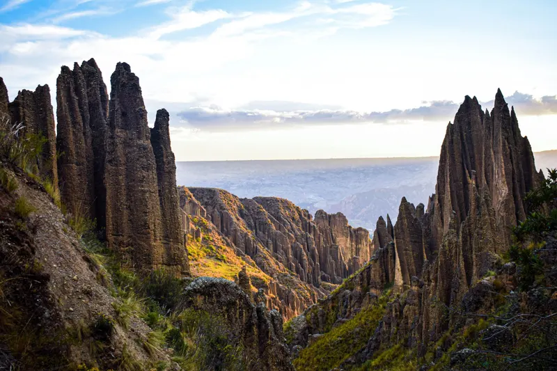
The Valle de las Ánimas (Valley of Souls) is a protected area of rock and clay spires on the southeast edge of La Paz, Bolivia, about 17 km from the center at 3,700 to 4,350 m. Take a PumaKatari bus or a minibus to Chasquipampa or Ovejuyo and walk in. The city says entry is free and suggests leaving by 4:00 p.m. (February 2026). Go with a guide or in a group.
On this page
- What is the Valle de las Ánimas and where is it?
- How to get to the Valle de las Ánimas from La Paz
- Routes: how far you walk and how hard it is
- Is it safe? Go with a guide or a group and leave by 4:00 p.m.
- Entry, hours and what to bring
- Tour or on your own?
- Valle de las Ánimas and the Palca canyon in one day
- Best season and time of day
- Valle de las Ánimas or Valley of the Moon?
- Frequently asked questions
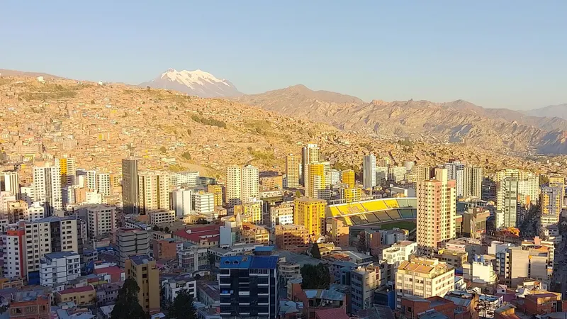
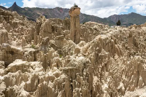
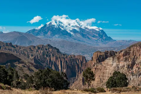
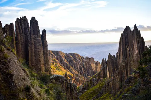
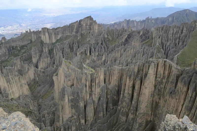
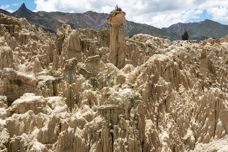
The Valle de las Ánimas is a protected area of rock and clay spires and walls on the southeast edge of La Paz, Bolivia, above the Ovejuyo and Chasquipampa neighborhoods. It covers 2,538 hectares split between the municipalities of La Paz and Palca, which dispute the boundary. It’s bigger and higher than the Valley of the Moon, with hiking between 3,700 and 4,350 m (12,100 to 14,300 ft), no boardwalks, no ticket office and mostly unmarked trails. Visiting rules come from the city’s tourism portal (February 2026); we checked fares, tours and alerts in September and November 2026.
- From the center
- About 17 km, 40 min to 1 h 30
- Altitude
- 3,700 to 4,350 m
- Hike
- 2 to 5 hours
- Entry
- Free, per city hall
- Suggested exit
- 4:00 p.m.
What is the Valle de las Ánimas and where is it?
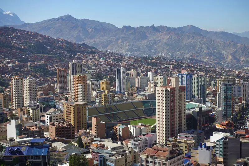
It sits in the Macrodistrito Sur, where the city runs out to the southeast. The formations continue toward Apaña, already in Palca municipality, and a dirt road crosses them on the way to Uni. From Plaza San Francisco it’s about 17 km by road to the trailhead (measured on OpenStreetMap; other sites say 15 or 20), and about 8 km from the Irpavi cable-car station.
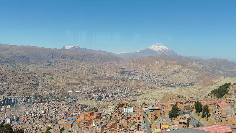
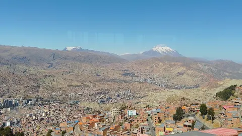
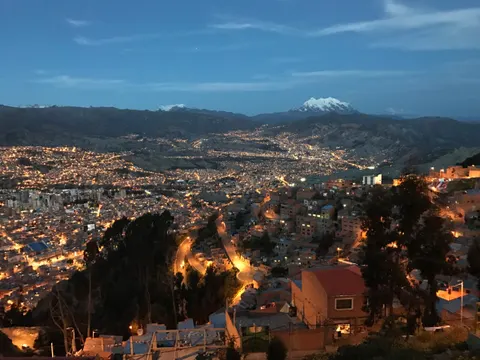
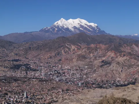
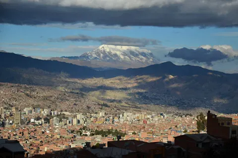
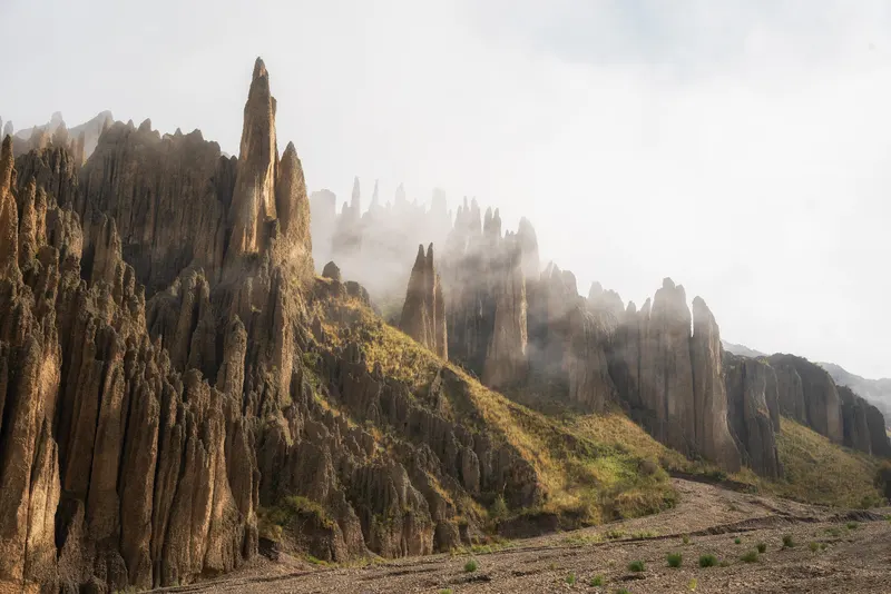
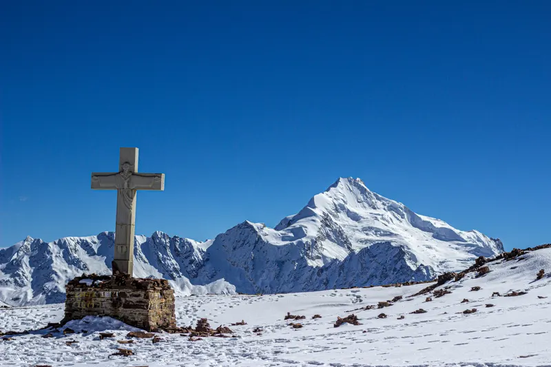
Wind and rain carved silt, clay and gravel into needles and columns that Spanish Wikipedia compares to a field of stalagmites. Citing specialists, the same source dates their origin to glacial melt at the end of the Tertiary. From the high points you see Illimani (6,438 m), Mururata and the city. City hall mentions condors and viscachas, but don’t count on either.
It has been a municipal protected area since 1995 and is a departmental natural monument. Wikipedia notes that unplanned urban growth threatens pre-Hispanic ceremonial structures nearby.
How to get to the Valle de las Ánimas from La Paz
| Option | One-way cost (Sep 2026) | Time | Best if |
|---|---|---|---|
| PumaKatari “Chasquipampa” from Plaza Camacho | Bs 2.50-3.50 (US$0.21-0.30) | 1 h to 1 h 30 | You fit its timetable |
| Micro or minibus “Ovejuyo” | Bs 2.50 micro, Bs 3.50 minibus | 40 min to 1 h 30 | You leave at any hour |
| Cable car to Irpavi plus taxi | Bs 5 (US$0.43) plus the taxi | ~50 min | You want to skip traffic |
| Taxi or ride app from the center | Whatever the app quotes | 25 to 45 min | There are three or four of you |
| Tour with transport | From about US$22 | 5 to 6 h in total | It’s your first time or you’re solo |
By PumaKatari or minibus
The PumaKatari is La Paz’s municipal bus. Micros are older buses, and minibuses are vans with the destination painted on the windshield that stop wherever you ask. Depending on where you get off, you enter from one of two sides:
- Calle 63 in Chasquipampa, the last stop of the PumaKatari “Chasquipampa” route from Plaza Camacho. Walk about three blocks to a sports field and head uphill toward Avenida Circunvalación, where the canyon starts.
- The end of Avenida Litoral in Ovejuyo (around Calle 60), the last stop for micros and minibuses marked “Ovejuyo”. The trail starts about 50 m away, beside the Quebrada Negra stream.
Under the city fares in force since December 25, 2025, a micro costs Bs 2.50 and a minibus Bs 3.50 for the long leg, and minibuses kept that fare after the September 2026 diesel price rise. Sources give Bs 2.50 to 3.50 for the PumaKatari; we found no official 2026 fare. Since August 2026, according to Mi Teleférico’s announcement, the Chasquipampa-Plaza Camacho route runs 7:00 to 8:30 a.m. and 4:40 to 8:40 p.m., and new La Paz Bus routes link Calle 63 with Irpavi cable-car station. Outside those hours, ask at the stop or take a minibus.
By cable car and taxi
The Light Blue line (from Prado station) and the Green line drop you at Irpavi after about 26 minutes in the cabin, for Bs 5 in total. From Irpavi it’s about 8 km, roughly 20 minutes by taxi along Avenida Muñoz Reyes, or the new La Paz Bus routes to Calle 63. Hours and cards are in our La Paz cable car guide.
By taxi or ride app
Uber, inDrive and Yango work in La Paz and show the fare before you book; we found no verified 2026 fare to Ovejuyo. On the street, use a radio taxi and agree the price before you get in. Taxis can be scarce in Ovejuyo for the ride back, but minibuses pass on the same avenue. If you stay in Zona Sur (Calacoto, San Miguel), you’re closer; compare neighborhoods in where to stay in La Paz. Carry small notes for fares and a possible access fee; how to change dollars after the boliviano float is in our Bolivia currency guide.
Routes: how far you walk and how hard it is
| Route | Distance | Time | Climb | Max altitude | Difficulty (our read) |
|---|---|---|---|---|---|
| Into the canyon and back | Varies | 2 to 3 h | Depends how far in | Up to ~4,000 m | Easy to moderate, always above 3,700 m |
| Main viewpoint with a guide | Short, out and back | 1 h 30 to 3 h | ~300 m | ~4,040 m | Moderate |
| Full ridge loop | 8 to 10 km | 4 to 5 h | 650 to 700 m | ~4,350 m | Hard; acclimatized only, with a track or guide |
AllTrails puts the loop at 9.7 km, 643 m of climbing and 4 to 4.5 hours; the Lamb on the Rhodes blog at 8 to 9 km, 688 m and 4 to 5 hours. Altitudes are our own reading of SRTM elevation data plus figures operators publish.
The loop starts at the end of Avenida Litoral, climbs to the ridge and comes back down the Ovejuyo river to Avenida Héroes del Chaco, near Rosas de Wilacota. Paths fork and are barely marked, so download the track first on Wikiloc, Maps.me or OsmAnd. Don’t climb the spires; they’re clay and gravel and they crumble.
The ridge sits about 700 m above the center (3,640 m). The US CDC puts the risk of altitude sickness from 2,450 m and advises against going higher with symptoms. Do this hike after two or three nights in the city, and turn back if you get a headache or nausea. More in our La Paz altitude sickness guide.
Is it safe? Go with a guide or a group and leave by 4:00 p.m.
On its Valle de las Ánimas page (February 2026), La Paz city hall suggests leaving by 4:00 p.m. to avoid security problems. It also asks for sturdy shoes, water and food, since there are few places to eat nearby.
In March 2025, La Razón reported that the city’s emergency team spent four hours, in cold and bad weather, searching for three Italian tourists. A sudden rise in the streams had cornered them and they had climbed onto a high ledge. They were found with signs of hypothermia after calling the city’s Red 114 line, and the team’s commander asked people to stay off the mountain on rainy days because the rivers rise fast.
Add unmarked trails, exposed edges and slippery slopes, and the advice is simple: go with a guide or, at the very least, in a group.
If you go without a guide
- Go with at least one other person and tell someone your route and return time.
- Start in the morning and be out of the valley by 4:00 p.m.
- Don’t go after rain or with storms forecast, especially November to March.
- Carry the track offline and a spare battery.
- Emergencies: police 110, fire 119, ambulance 118 (Canada’s government lists 165) and the city’s Red 114 line.
The wider picture is in is La Paz safe?, and current road conditions in Bolivia travel status.
Entry, hours and what to bring
City hall lists the valley as free and always open (February 2026). The operator Jiwaki, though, listed a Bs 10 entry its tour didn’t include (August 2026), and other sites mention about Bs 5 at some access points, probably community-run. We couldn’t confirm who charges. Carry about Bs 20 in small notes (under US$2) in case you’re asked.
Google says it opens at 7:00 a.m., but it’s open country and the time that matters is when you leave. City hall says dogs are allowed.
Bring 1.5 to 2 liters of water per person, food, hiking shoes with good grip, layers and a windbreaker, sunscreen, a cap, sunglasses and lip balm, and a charged phone with the track.
Local custom
Bolivia Homeland Tours’ afternoon tour starts with a small offering to ask the souls for permission. There are pre-Hispanic ceremonial remains nearby: don’t touch them, don’t take stones, and carry your trash out.
Tour or on your own?
On your own you spend Bs 5 to 17 round trip, counting a possible access fee (under US$1.50). That makes sense if there are two or more of you, you’re already acclimatized, you have the track and it’s the dry season. A tour is worth it the first time, if you’re traveling solo, if you want sunrise or late-afternoon light, or to add the Valley of the Moon or Palca without juggling transport.
Check what each one includes. Bolivia Homeland Tours’ afternoon tour leaves from Plaza San Miguel, Plaza Avaroa or Calle Sagárnaga and spends about 3 hours in the valley with entry, a bilingual guide and a snack. It leaves the valley at 6:00 p.m., later than city hall suggests, to catch the low light. Wonder Tours picks you up at your hotel and spends 100 minutes in the Ánimas before the Valley of the Moon and Killi Killi, but doesn’t include the Valley of the Moon entry (Bs 15). Visit South America’s private tour includes entries and breakfast, not lunch.
Well-reviewed Valle de las Ánimas tours
Book on Viator From $22.14Mystical Afternoon in the Valley of Souls half-day tour
- Price
- From $22.14 per person
- Duration
- 5-6 h
- Rating
- Cancellation
- Free
 From $85Valle de Las Animas, Moon Valley and Killi Killi half day tour
- Price
- From $85 per person
- Duration
- 4-5 h
- Rating
- Cancellation
- Free
 From $165Valle de las Animas, Moon Valley, La Paz day tour Private
- Price
- From $165 per person
- Duration
- 10-12 h
- Rating
- Cancellation
- Free
Prices in US$ per person from Viator as of Sep 30, 2026. They change; you see the final price before paying.
Which one is for you?
- If you want a guide and a low price: the afternoon in the Valle de las Ánimas, from about US$22 with entry and a snack; you’re back in the center around 7:30 p.m.
- If you want two valleys and a viewpoint in one morning: Ánimas, Valley of the Moon and Killi Killi, from about US$85. More on the La Paz viewpoints.
- If you want sunrise and the day handled: the private sunrise tour in the Ánimas, from about US$165, with breakfast and entries.
- If you’re acclimatized, in a group and have the track: go on your own by PumaKatari or minibus.
What we'd skip
- The full loop on your own in your first days in La Paz.
- Any outing with a storm on the way.
- “Valle de las Ánimas” listings with 0 to 2 reviews. Among Viator tours focused on the valley, only the three above had between 46 and 83 reviews in September 2026; the rest had 12 or fewer.
More guided trips from the city are in the best La Paz tours.
Valle de las Ánimas and the Palca canyon in one day
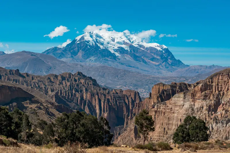
Palca, capital of Murillo province, is a village below Illimani and Mururata with a colonial church listed as national heritage. From Ovejuyo the same road climbs to Uni (about 3,930 m) and drops to the village (about 3,465 m), some 20 km from the Ánimas trailhead and 37 km from Plaza San Francisco.
Operators say the canyon takes 45 minutes to 1 h 30 on sandy clay. Its floor, at about 3,400 m, is lower than anywhere in the Ánimas, so it’s the easy walk of the day. We couldn’t confirm whether it charges entry.
By public transport it’s hard work. Buses to Palca leave San Pedro irregularly, and Wikipedia estimates about two hours on the road, so to see both places in a day you need a vehicle. Local operators’ combined tours last 6 to 8.5 hours and sell from about US$95 outside Viator. On Viator, the only Palca tour with more than one review is the Palca canyon with an optional Ánimas stop, private, from about US$150 (4.6 from 19 reviews).
Best season and time of day
April to October
Dry seasonClear skies, dry streambeds and cold mornings. La Paz gets about 5 mm of rain in all of July.
Verdict: the time to go, especially May to September.
November to March
Rainy seasonAfternoon storms and streams that rise fast in the canyon floors. January brings about 125 mm.
Verdict: only with a guide, in the morning, with a good forecast.
On your own, leave the center between 8:00 and 10:00 a.m. to be out before 4:00 p.m. The low light photographers want comes at sunrise and late afternoon, and those hours are best left to tours. Month-by-month weather is in La Paz weather and the best time to visit Bolivia.
Valle de las Ánimas or Valley of the Moon?
| Valle de las Ánimas | Valley of the Moon | |
|---|---|---|
| Type | Open area, unmarked trails | City park with walkways |
| Altitude | 3,700 to 4,350 m | About 3,300 m |
| From the center | About 17 km | About 12 km |
| Entry (Sep 2026) | Free per city hall; Bs 5-10 reported | Bs 15 foreigners, Bs 3 Bolivians |
| Hours | Always open; leave by 4:00 p.m. | 9:00 a.m. to 6:00 p.m. per city hall |
| Walk | 2 to 5 h | 15 or 45 min |
| Guide | Recommended | Not needed |
The Valley of the Moon suits your first days in the city; the Ánimas is for when you’re acclimatized and want a few hours on foot. Wonder Tours’ tour above combines both in a morning. Chacaltaya, above 5,300 m, is for when you’ve had several days at altitude.
Current conditions (November 2026)
We found no closure notices for the valley in 2026. The November-March rains raise flash-flood risk in the canyons, so check the forecast the day before. After diesel prices were freed on September 18, La Paz minibuses kept their fares. For protests and road blockades, see Bolivia travel status.
To plan the rest of your week, see day trips from La Paz and things to do in La Paz.
Frequently asked questions
Where is the Valle de las Ánimas?
On the southeast edge of La Paz, Bolivia, above the Ovejuyo and Chasquipampa neighborhoods in the city's Zona Sur. The formations continue toward Apaña in Palca municipality, so the protected area straddles both. The trailhead is about 17 km by road from Plaza San Francisco and about 8 km from the Irpavi cable-car station.
Why is it called the Valley of Souls?
Local legend. Spanish Wikipedia records two versions from local villagers: the wind makes a mournful sound as it passes between the spires, and the tall shapes look like the silhouettes of spirits. La Paz city hall says the rocks resemble people and animals, which is where the belief that souls of the dead wander the valley comes from. It's also called the Valle de las Almas.
How do you get to the Valle de las Ánimas by public transport?
Take a micro or minibus marked 'Ovejuyo' to the end of Avenida Litoral (Bs 2.50 by micro, Bs 3.50 by minibus, about US$0.21-0.30), or the PumaKatari 'Chasquipampa' bus from Plaza Camacho to Calle 63 (Bs 2.50-3.50), September 2026 fares. Since August 2026 that PumaKatari route runs limited hours. Or ride the cable car to Irpavi (Bs 5) and take a 20-minute taxi.
Is there an entrance fee for the Valle de las Ánimas?
La Paz city hall says entry is free (February 2026). Even so, one tour operator listed a Bs 10 entry in August 2026, and other sites mention about Bs 5 for upkeep at some access points, probably community-run. Carry about Bs 20 in small notes (under US$2). Bolivia Homeland Tours' afternoon tour includes the entry.
Is it safe to hike without a guide?
It can go wrong. Many trails are unmarked and the canyon floors are streambeds that flood after rain. In March 2025 city rescuers spent four hours searching for three tourists trapped by a flash flood, who were found with signs of hypothermia. If you go alone, go as a group, with the track downloaded, in good weather only, and leave by 4:00 p.m.
How long is the hike and how high does it go?
Walking into the canyon and back takes 2 to 3 hours; the full ridge loop is 8 to 10 km and 4 to 5 hours. The Ovejuyo trailhead sits at about 3,700 m, the central formations at about 3,965 m and the ridge of the long loop at about 4,350 m, up to 700 m above central La Paz, so go after two or three nights in the city.
Keep planning