

Quick answer
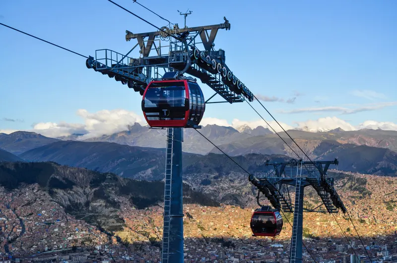
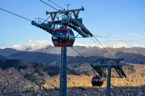
El Alto is the separate city on the rim above La Paz, Bolivia, at about 4,000-4,150 m (13,100-13,600 ft), and it has more people than La Paz itself (885,035 in the 2024 census). The Red Line cable car climbs there in 11 minutes for Bs 3 (about US$0.25). Go on a Thursday or Sunday for the Feria 16 de Julio market, then add the neo-Andean cholets and the view from the rim.
On this page
- El Alto, Bolivia vs La Paz: what’s the difference?
- How high is El Alto? Elevation and altitude tips
- How to get from La Paz to El Alto
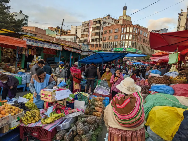
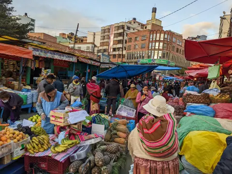
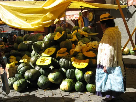
- The 16 de Julio market (Feria 16 de Julio)
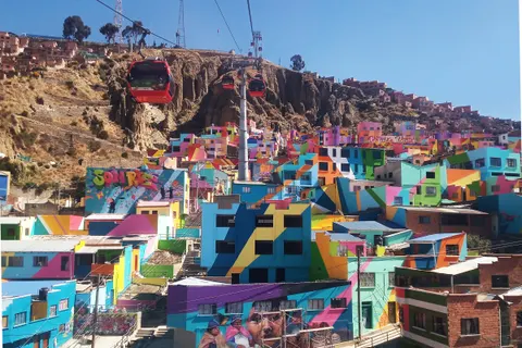
- Cholets: El Alto’s neo-Andean architecture
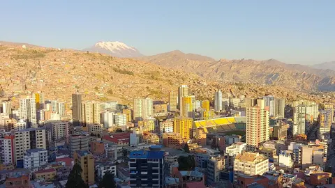
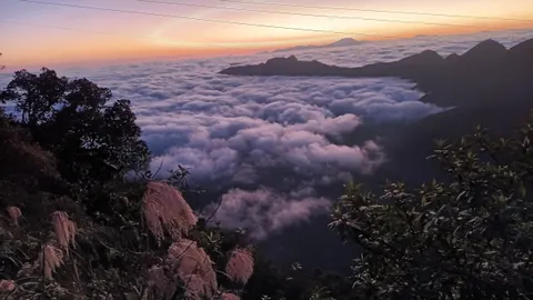
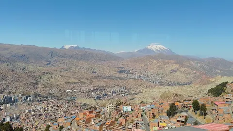
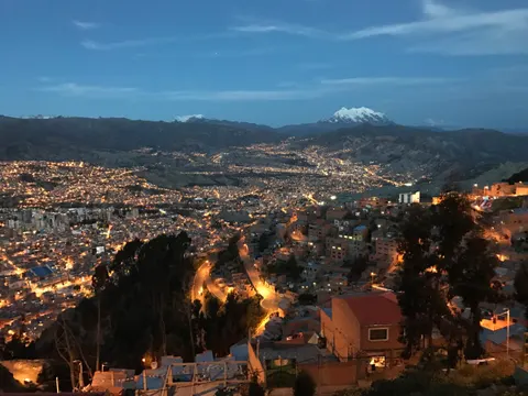
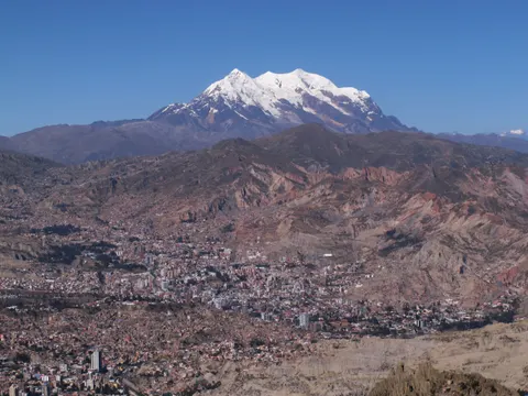
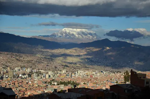
- The best views from El Alto’s rim
- La Ceja, the yatiris and the Che Guevara monument
- Cholita wrestling in El Alto
- A half day in El Alto: DIY route or tour
- Is El Alto worth visiting?
- Is El Alto safe? Tips and 2026 conditions
- A short history of El Alto
- El Alto as a gateway
- Frequently asked questions
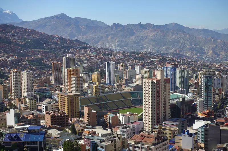
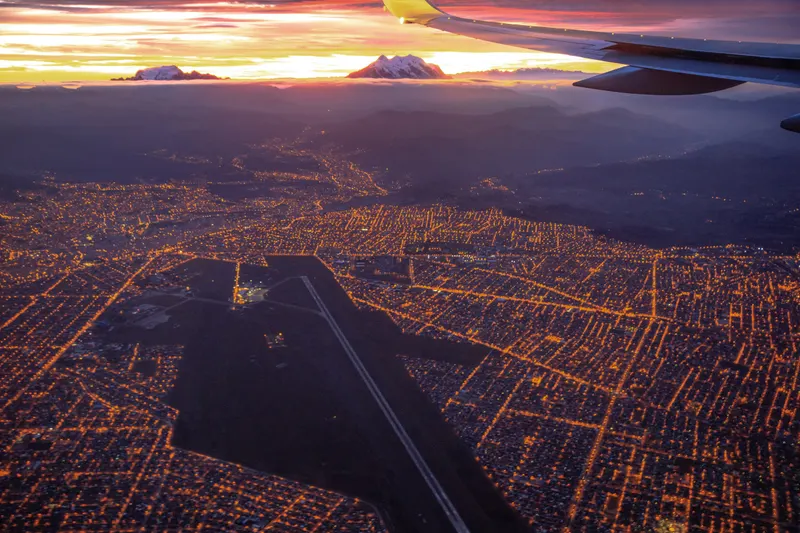
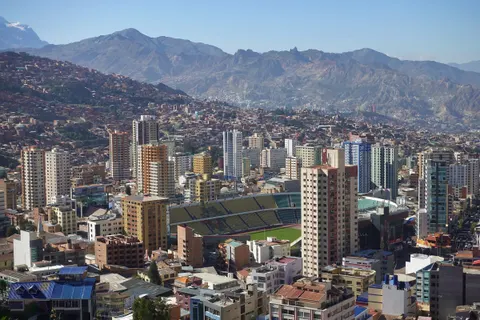
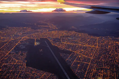
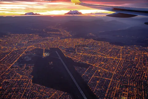
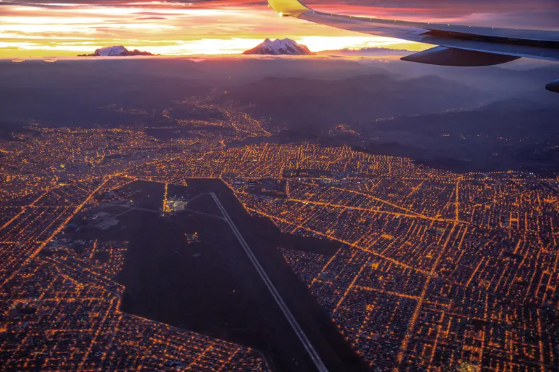
If you flew into La Paz, you landed in El Alto, Bolivia. The airport, at 4,061.5 m (13,325 ft), belongs to a separate city spread across the Altiplano on the rim of the La Paz canyon. El Alto has governed itself since 6 March 1985 and now outnumbers its older neighbor, 885,035 people to 755,732 in the 2024 census. Most residents are Aymara and call themselves alteños.
Visitors ride up for four things: the Feria 16 de Julio, a street market (feria) that fills about 200 blocks every Thursday and Sunday; the brightly painted buildings called cholets; the view down into La Paz; and cholita wrestling. All four sit a cable-car ride from downtown. For the city below, start with our La Paz travel guide and our list of things to do in La Paz.
- Elevation
- 4,000-4,150 m (13,100-13,600 ft)
- From downtown
- 11 min on the Red Line cable car
- Fare (Sep 2026)
- Bs 3 (about US$0.25)
- 16 de Julio market
- Thursdays and Sundays
- Cholita wrestling
- Sunday afternoons (city show)
El Alto, Bolivia vs La Paz: what’s the difference?
| El Alto | La Paz | |
|---|---|---|
| Status | Own municipality since 1985 | Bolivia’s seat of government |
| Population (2024 census) | 885,035 | 755,732 |
| Setting | Flat Altiplano, about 4,000-4,150 m | A canyon, about 3,640 m downtown |
| What you’ll use it for | Airport, market, cholets, rim views, wrestling | Your hotel, museums, the Witches’ Market |
Three cable-car lines (Red, Yellow and Purple) climb from La Paz to El Alto, and two more (Blue and Silver) run inside El Alto. The highways to Lake Titicaca and Oruro start at La Ceja, El Alto’s commercial center, so road trips to Copacabana, Tiwanaku and Uyuni all cross the city.
El Alto is known for the market, the cholets, an airport and a stadium above 4,000 m, and the 2003 Gas War, the protests over plans to export natural gas, in which La Ceja was a center of the unrest.
How high is El Alto? Elevation and altitude tips
El Alto sits at about 4,000-4,150 m (13,100-13,600 ft). Sources disagree: Wikipedia gives both 4,150 m and an average of 4,000 m, and La Ceja, the center, is listed at 4,091 m (13,422 ft). Downtown La Paz is at about 3,640 m (11,940 ft), so El Alto is 400-500 m (1,300-1,650 ft) higher and one of the highest large cities in the world.
The Red Line covers about 400 m of that climb in 11 minutes. The CDC already rates flying straight into La Paz as high risk for altitude illness (soroche in Bolivia). It advises no alcohol for the first 48 hours and, above 3,000 m, raising your sleeping altitude by no more than 500 m a night. Visit El Alto on your second or third day and sleep back down in La Paz. Symptoms and remedies are in our altitude sickness guide.
El Alto weather by month
| Month | Avg high °C (°F) | Avg low °C (°F) | Rain (mm) |
|---|---|---|---|
| Jan | 14.6 (58) | 4.2 (40) | 134 |
| Feb | 14.6 (58) | 4.1 (39) | 105 |
| Mar | 14.8 (59) | 3.4 (38) | 72 |
| Apr | 15.1 (59) | 1.4 (35) | 32 |
| May | 15.1 (59) | -1.9 (29) | 14 |
| Jun | 14.3 (58) | -3.7 (25) | 5 |
| Jul | 14.1 (57) | -4.1 (25) | 7 |
| Aug | 15.1 (59) | -3.1 (26) | 15 |
| Sep | 15.7 (60) | -0.7 (31) | 36 |
| Oct | 16.2 (61) | 1.4 (35) | 38 |
| Nov | 17.0 (63) | 2.4 (36) | 51 |
| Dec | 16.0 (61) | 3.7 (39) | 95 |
1991-2020 averages from the El Alto airport station (4,058 m), via Wikipedia (DWD, Meteo Climat and SENAMHI data).
Nights drop below freezing from May to September, and July nights run about 7 °C (12 °F) colder than downtown. Most rain falls from November to March. Snow falls on fewer than two days a year on average, yet on 24 August 2026 a snowfall forced more than 60 flights to be cancelled at El Alto airport. For today’s forecast, check SENAMHI, Bolivia’s weather service; for the city below, see La Paz weather by month.
How to get from La Paz to El Alto
Take the cable car. Mi Teleférico’s Red Line reaches El Alto in 11 minutes, while the road takes 30 minutes to over an hour depending on traffic. The cable car also copes better with trouble: during 51 days of road blockades in 2026 the network carried 15.8 million passengers, according to the operator.
| Line | Board at | Get off at | Ride | Why take it |
|---|---|---|---|---|
| Red | Estación Central, the old railway station | 16 de Julio | 11 min | Straight to the market, over the Cementerio General and the painted houses of Chualluma |
| Purple | San José, 500 m from Plaza Murillo | Faro Murillo or 6 de Marzo | 8-16 min | Fastest from the old center |
| Yellow | Libertador or Sopocachi | Mirador | 17 min | Best way down, a drop of about 650 m facing Illimani |
| Blue | 16 de Julio (El Alto only) | Plaza Libertad to Río Seco | 20 min | Over the market stalls and cholets |
| Silver | 16 de Julio (El Alto only) | Faro Murillo, Mirador | 12 min | Along the rim |
A ride costs Bs 3 plus Bs 2 per transfer (about US$0.25 and US$0.17 as of September 2026). Walk out of a station and back in, and you pay Bs 3 again. Pay cash in coins or Bs 10 notes, because QR payment needs a Bolivian bank app. Since 20 September 2026 the lines run 06:30-22:30 every day, Sundays included (ABI); public holidays keep 07:00-21:00, and some pages still show an older 06:00-23:00 timetable. All 10 lines are in our La Paz cable car guide.
By road, minibuses with “Ceja” on the windshield climb from downtown; we couldn’t verify a 2026 fare. For a taxi, call a radio taxi and agree the price before you get in.
Election Sundays
When an election falls on a Sunday, the Feria 16 de Julio moves to Saturday, as it did on 16 August 2025 and 21 March 2026, and Mi Teleférico doesn’t run on voting day. Check the calendar before you plan a Sunday up top.
From 16 de Julio station, La Ceja is 700 m away in a straight line, Plaza Libertad station 1 km and Faro Murillo station 2 km.
The 16 de Julio market (Feria 16 de Julio)
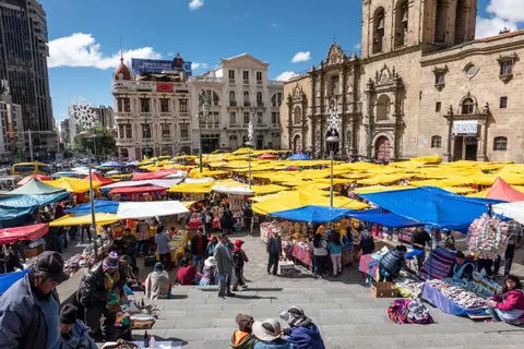
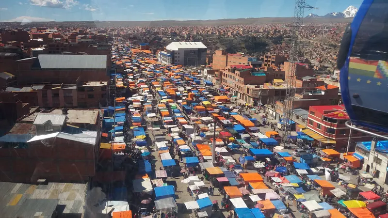
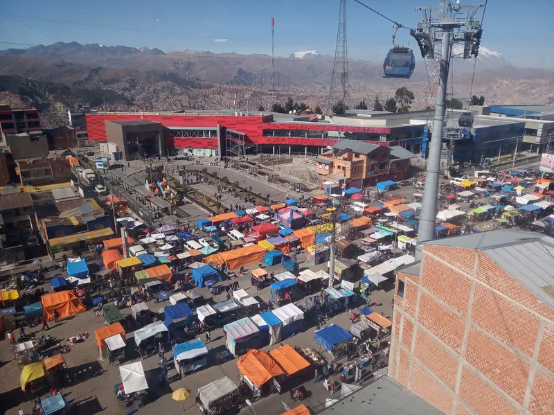
El Alto’s market, the Feria 16 de Julio, fills about 200 blocks of the 16 de Julio district every Thursday and Sunday. Spanish Wikipedia calls it one of the largest markets in Bolivia and Latin America; in 2018 it involved at least 11,000 people and moved about US$2 million a week. Several blogs say it covers 5 km², a figure we couldn’t verify. The cable-car station at its edge carries the Aymara name Jach’a Qhathu, “big market”.
The same source counts 22 categories of goods, from used clothes, car parts and whole cars to antiques, books, plants, pets and farm animals, with food stalls throughout.
Get off the Red Line at 16 de Julio and walk along Avenida 16 de Julio under the Blue Line cables to Plaza Libertad station, about 1 km, then ride the Blue Line back over the awnings. The market has no official hours. One travel blog gives 6 am to 3 pm; we’d aim for 10:00-14:00, when the stalls are fully set up and the day is at its warmest.
The feria kept trading through the May 2026 blockades, with few buyers or sellers, and on 17 May vendors confronted the blockaders to keep their stalls open (eju.tv).
Market-day kit
Carry Bs 10 notes and coins inside your clothes, because stalls often can’t break a Bs 100 (more in our Bolivian money guide). Keep your phone zipped away, wear your backpack on your front and bring a warm layer even in full sun. The operator lists toilets at 16 de Julio station. Pick one or two sections, because nobody walks all 200 blocks.
Cholets: El Alto’s neo-Andean architecture
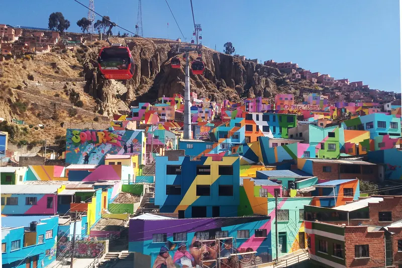
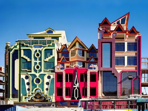
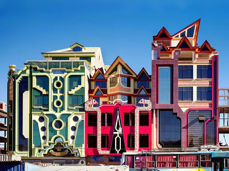
Cholets are the multicolored buildings, several stories tall, that you’ll spot all over El Alto. The style, neo-Andean architecture, started with Freddy Mamani Silvestre, born in Catavi in 1971 and raised in El Alto from age six. He worked as a bricklayer’s assistant from 14, later earned a civil construction degree, and took his first commission from an El Alto businessman in 2002.
A typical cholet stacks shops at street level, a double-height party hall (salón de eventos) above them, then apartments, with the owner’s house on the roof, the “chalet” in the name. The colors come from the aguayo, the striped cloth Aymara women use to carry loads on their backs, and the motifs from Tiwanaku and the chakana, the stepped Andean cross. The Guardian put the cost of one at US$200,000-500,000 in 2018. Most went up after 2006, commissioned by El Alto’s Aymara merchants. The name joins cholo or chola (Bolivian terms for urban Aymara and mestizo people) with chalet, and it started as a put-down.
El Alto has more than 100 neo-Andean buildings. Wikipedia credits Mamani with more than 60 of them, while The Guardian counted over 100 of his in 2018. He also built a ballroom for the Fondation Cartier’s “Southern Geometries” exhibition in Paris, which ran until February 2019.
Spot them from the Blue Line and in the streets around the market. Most are private buildings, so to get inside one, book the 3-hour cholet tour that enters a cholet. For the women behind the name, read about the cholitas of La Paz and their bowler hats.


The best views from El Alto’s rim
Three spots on the cable-car network give you the view down into La Paz for the price of a ride:
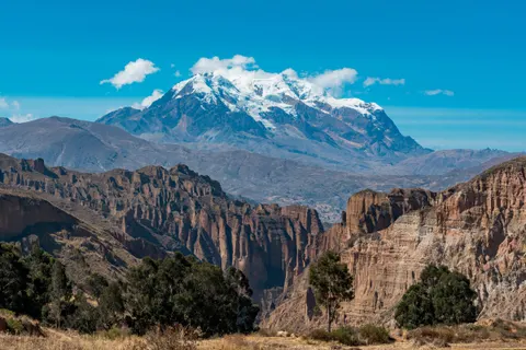
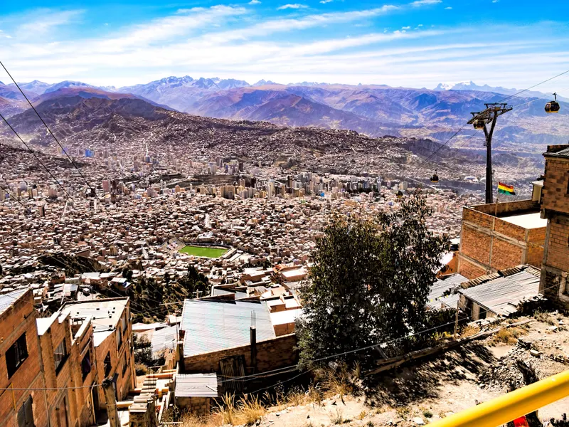
- 16 de Julio: Walk out of the station onto Avenida Panorámica Norte for the canyon and, on a clear day, Illimani.
- Mirador (Qhana Pata): The station beside the satellite antennas in Ciudad Satélite, where the Yellow Line starts its drop into the city.
- Silver Line: The 12-minute ride between those two stations runs along the edge.
Illimani shows most reliably in the dry season, May to October. For Killi Killi and the viewpoints inside the city, see our La Paz viewpoints guide.
La Ceja, the yatiris and the Che Guevara monument
La Ceja (“the eyebrow”) is El Alto’s commercial and administrative center, at 4,091 m. Three avenues meet here: Juan Pablo II, which becomes the road to Copacabana; 6 de Marzo, which becomes Ruta Nacional 1 to Oruro; and Tiahuanacu, toward Viacha. A monument to Che Guevara stands in the area.
Between the Sagrado Corazón area and Faro Murillo, stalls sell herbs and ritual offerings, with no souvenirs in sight. Yatiris, Aymara healers who read coca leaves and prepare offerings, work from small cabins nearby. Look, but don’t photograph them. Downtown’s Witches’ Market is the tourist-facing version of the same trade.
Cholita wrestling in El Alto
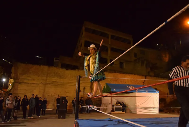
El Alto’s city hall brought cholita wrestling back to the Multifuncional “Heriberto Gutiérrez” with a free show at 15:00 on 26 July 2026 and promised bouts every Sunday at “popular prices” (ABI). It hasn’t published the start time or price for later Sundays, so confirm before you go. Private promoters run tourist shows most afternoons from about 17:00 at other El Alto venues, some in cholet party halls, and those end after dark. Operators and blogs quote Bs 50-80 (US$4-7) a ticket, or Bs 90-150 (US$7.50-12.50) with transport from downtown (September 2026). Mapamundi Go’s package with transport from downtown rates 3.95 from 40 reviews, so read them before you book. Venues and schedules are in our cholita wrestling guide.
A half day in El Alto: DIY route or tour
This route takes 3-4 hours on a Thursday or Sunday and costs Bs 10 (about US$0.85) in fares:
- Ride the Red Line from Estación Central to 16 de Julio (Bs 3), over the cemetery and Chualluma.
- Step outside for the view from Avenida Panorámica, then head into the market.
- Walk Avenida 16 de Julio to Plaza Libertad station, about 1 km.
- Ride the Blue Line back to 16 de Julio (Bs 3), transfer to the Silver Line for Mirador (Bs 2), then take the Yellow Line down to Sopocachi or Libertador (Bs 2).
On other days, skip the walk and ride Red, Silver and Yellow without leaving the stations, for Bs 7.
Which one is for you?
- If it’s Thursday or Sunday and crowds don’t bother you: Do the route above on your own.
- If you want to see inside a cholet: The cholet tour leaves daily from the Purple Line’s downtown station, with snacks and a guide in English or Spanish.
- If you have a free afternoon: The cable car, cemetery and El Alto tour starts at 14:00, includes cable-car tickets and cemetery entry, and walks the market on Thursdays and Sundays.
- If it’s Sunday: Market in the morning, then cholita wrestling in the afternoon.
- If you’re a group that wants its own guide: The private cholet tour takes 4-5 hours, from about US$48.
- If you landed less than 48 hours ago: Hold off until day two or three and start downtown; our guide to altitude sickness in La Paz explains why.
El Alto tours with the cable car
Book on Viator From $35Cholet Tour - Andean Architecture and Culture - El AltoFree cancellationCheck availability
 From $22Cable Car, Cementery, Shaman and El Alto Adventure in La PazFree cancellationCheck availability
 From $25El Alto and Aymara MansionsFree cancellationCheck availability
Prices in US$ per person from Viator as of Sep 30, 2026. They change; you see the final price before paying.
Viator lists few El Alto tours; these three rate 4.7-4.8 from 31 to 139 reviews (September 2026). La Paz’s most-reviewed city tour, the City Tour plus Cable Car (588 reviews, from about US$10), also rides to El Alto and, on Thursdays and Sundays, through part of the market. More in our best La Paz tours.
Is El Alto worth visiting?
Pros
- The view over the whole La Paz canyon to Illimani, for a Bs 3 fare
- One of Latin America’s largest street markets, twice a week
- Cholets, a building style that started here in 2002
- About US$0.85 in fares for the half-day route
- Pairs with cholita wrestling on the same Sunday
Cons
- 400-500 m higher than downtown, with freezing nights from May to September
- Market crowds and pickpockets
- On non-market days, little to see on foot without a guide
- The government lists El Alto among its protest hot spots (September 2026)
Our take
Worth a Thursday or Sunday morning from your second or third day. Ride the Red Line up and the Yellow Line down, and the fares come to less than a dollar. Pay for a tour only if you want to get inside a cholet or would rather not handle the market crowds alone. On other days, ride the Silver Line along the rim for the view and stay in the cabins.
Is El Alto safe? Tips and 2026 conditions
By day, with care, yes. The US State Department says its employees in Bolivia “are encouraged to pay extra attention to their surroundings in El Alto because of petty crime” and advises US citizens to do the same (August 2026). Spain warns about certain El Alto neighborhoods without naming them. On the ground, watch for pickpockets in the market, fake police (real officers can’t search you on the street without a prosecutor’s order) and the spilled-liquid trick, where one person “helps” you clean up while another takes your bag. Use radio taxis, and ride back down before dark rather than wait around La Ceja. More in our Bolivia safety guide.
Current conditions (September 2026)
A state of exception has been in force since 20 June 2026 and was extended to about mid-December. Road blockades from 1 May to 23 June cut off La Paz and El Alto, and on 18 May several cable-car lines stopped over protests in El Alto (all ran again by 21 May). In September the Defense Minister still named El Alto among the main risk spots, while saying unrest had decreased considerably. The diesel subsidy ended on 18 September; heavy-transport unions have since threatened blockades, and some El Alto groups have called for protests (Opinión, 24 September). Expect taxi and tour prices to rise, and check local news on the day you go up.
What to skip
Going up the day you land. Walking La Ceja after dark or with your phone in your hand. Photographing yatiris. Trying to see all 200 blocks of the market. Hailing taxis on the street.
A short history of El Alto
On 23 October 1548 the Spanish captain Alonso de Mendoza stopped at the spot now called La Ceja and looked down on the valley. The plateau stayed almost empty until railways from Lake Titicaca and Arica reached the rim in the early 1900s (sources say 1903 or 1904). Villa Dolores, the first housing development, dates from 1942, and rural migrants settled the plateau from the 1950s on. El Alto became its own municipality on 6 March 1985 and a city in 1988 (English Wikipedia says 1987). In 2003 La Ceja was a center of the Gas War, which left more than 60 people dead. The Red Line, the first cable car up from La Paz, opened on 30 May 2014, and the 23,000-seat municipal stadium followed in 2017.
El Alto as a gateway
No cable-car station serves the airport; see our El Alto airport guide for taxis and transfers. Sleep in El Alto only before a pre-dawn flight, and only once you’ve acclimatized; for that night, compare hotels in El Alto on Expedia. Otherwise, pick where to stay in La Paz. Day trips to Tiwanaku, Chacaltaya, Huayna Potosí, Copacabana and Sorata all cross El Alto, and minibuses to Sorata also leave from Río Seco, at the end of the Blue Line. More ideas in our day trips from La Paz.
Frequently asked questions
What is the difference between El Alto and La Paz?
They are two separate cities. El Alto has run its own municipality since 1985, sits on the flat Altiplano at about 4,000-4,150 m and counted 885,035 people in the 2024 census. La Paz fills the canyon below, 400-500 m lower, with 755,732 people and Bolivia's seat of government. The airport is in El Alto, and three cable-car lines (Red, Yellow and Purple) connect the two.
What is El Alto known for?
Its Feria 16 de Julio, held every Thursday and Sunday, is one of the largest street markets in Bolivia and Latin America. El Alto is also known for the brightly painted cholet buildings of Freddy Mamani and the builders who followed him, cholita wrestling, an airport and a football stadium above 4,000 m, and its role in the 2003 Gas War protests. Most residents are Aymara.
How high is El Alto, Bolivia, in feet?
About 13,100-13,600 ft (4,000-4,150 m); sources give different figures. La Ceja, the city center, is listed at 4,091 m (13,422 ft), and El Alto International Airport at 4,061.5 m (13,325 ft). Downtown La Paz sits at about 3,640 m (11,940 ft), so the trip up adds roughly 1,300-1,650 ft. Save it for your second or third day in La Paz.
When is the El Alto market?
The Feria 16 de Julio runs every Thursday and Sunday. When an election falls on a Sunday, it moves to the Saturday before, as it did on 16 August 2025 and 21 March 2026, and the cable car stops on voting day. There are no official hours. Stalls trade from morning to mid-afternoon, and we'd go between 10:00 and 14:00.
Is El Alto safe to visit?
By day, yes, if you keep your phone zipped away, carry small bills and wear your bag in front in the market crowds. The US State Department asks its staff and US citizens to pay extra attention in El Alto because of petty crime (August 2026). A state of exception runs to about mid-December 2026, so check the news before you go up and ride back down before dark.
What is the population of El Alto?
885,035 people in Bolivia's 2024 census, up from 848,452 in 2012 and ahead of the 755,732 counted in the municipality of La Paz. Websites that say El Alto has over a million people are repeating older estimates; no census has counted that many. Spanish Wikipedia puts the combined La Paz-El Alto metro area at about 2.2 million.
How high is El Alto's football stadium?
The Estadio Municipal de El Alto, in the Villa Ingenio district, sits at 4,088 m (13,412 ft). It opened on 16 July 2017 with a Bolívar vs The Strongest match, seats 23,000 on artificial turf and is home to the club Always Ready. Bolivia's national team plays selected home matches there, about 450 m above downtown La Paz.
Keep planning